FT lightweight wind sensors are being used on drones to advance NASA research into urban area microclimate predictions
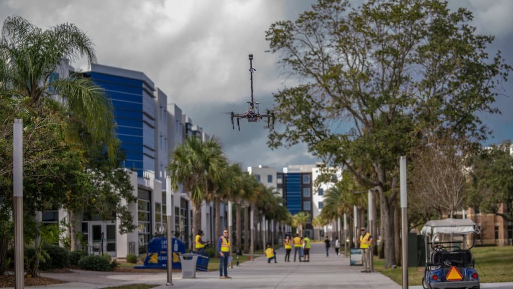
The NASA funded research project named GUMP (General Urban area Microclimate Prediction tool) uses UAV’s to collect weather data at different elevations. The data will be used in a study to micro forecast weather scenarios that would affect UAV’s that would be delivering payloads. (Photos: Embry-Riddle/David Massey)
A wide variety of services exist for macro weather prediction, but when it comes to how wind and storms impact unmanned aircraft systems (UAS), or drones — namely those meant for drone package delivery and air taxis — more localized forecasts are needed. That’s where researchers at Embry-Riddle Aeronautical University come in, as they contribute to a NASA project to develop tools for assessing and predicting hyperlocal weather conditions.
Researchers at Embry-Riddle Aeronautical University helped bring the goal of widespread drone delivery service and air taxis closer to fruition, by flying small un-crewed aircraft systems (sUAS) along simulated delivery routes in Florida. The exercise proved the viability of the hyperlocal weather-prediction tools needed to fly autonomous systems in populated areas.
“Without good weather products, these aircraft may be unnecessarily grounded, delaying the delivery of goods and services,” said Dr. Kevin Adkins, associate professor in Embry-Riddle’s College of Aviation.
With most UAS weighing less than 55 pounds, even mild gusts of wind could disrupt their flight. Especially in metropolitan areas, where tall buildings can create unpredictable weather forces, more sophisticated forecasting software is needed to ensure that aircraft can operate both safely and efficiently.
“Micro weather forecasting is essential with drone deliveries,” said Avinash Muthu Krishnan, a Mechanical Engineering doctoral student who helped design and build the meteorological software equipped on the drones. “With drone delivery also comes automation of drones for beyond-visual-line-of-sight flight. You need to be 100% with the success rate of the drone flying uninterrupted to and back from a destination. Without weather predictions along the route, a lot of uncertainty is added.”
The research, which started in 2020 on Embry-Riddle’s Daytona Beach Campus, endeavors to filter weather data from the National Oceanic and Atmospheric Administration and nearby ground stations through 3D models of urban environments to refine forecasts to specific locations. The team’s General Urban area Microclimate Predictions tool (GUMP) leverages machine learning and Computational Fluid Dynamics (CFD) simulations to convert computer wind flow fields into an intuitive risk map for sUAS operators.
“Think of air taxis or drone delivery and you probably think of hundreds of small aircraft flying relatively low over large metro areas,” Adkins said. “This is a dense operation in a part of the atmosphere where conditions are constantly changing. This will be a brand new environment for aviation, and tools like GUMP are needed to help make it efficient and safe.”