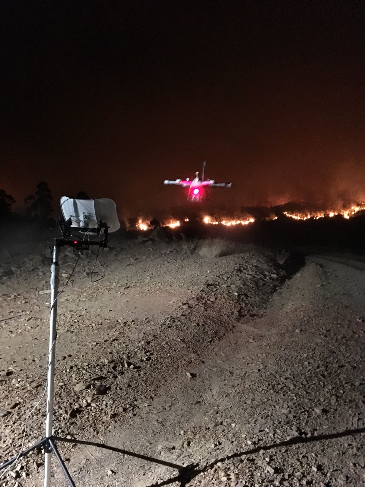
Monitoring the progress of forest fires at night using a drone equipped with an FT205 wind sensor.
Background
When trying to predict the progress of a forest fire, one of the most important pieces of information to consider is the intensity and direction of the wind. Armed with this knowledge, it is possible to take preemptive action, such as controlled burning in specific areas to prevent the fire from advancing.
In Andalusia, Spain, forest fires are a regular occurrence during the summer months. Until recently, the only way to predict the wind was by gathering data from low altitude weather stations. Although producing reasonably accurate data, the stations were often located several kilometres from the fire front, usually within the same incident command centres controlling the emergency services.
By day, planes are able to fly above the fire and report its progress. However, at nightfall, all piloted aircraft must stop their operations for safety reasons. The lack of wind data during the night could often have disastrous consequences.
During the summer of 2018, AMAYA and INFOCA (the authority dedicated to the prevention and extinction of forest fires in Andalusia) jointly funded a project to test a new drone specifically designed to fly at night in order to monitor wind speed and direction directly at the fire front. Developed by Dronetools SL, the drone was equipped with an FT205 wind sensor.
Before testing the sensor on real fires, field tests were carried out 15 metres above the ground in order to compare the results with a weather station and confirm that the sensor’s data was correct.
Results:
Throughout the summer, the drone equipped with the FT205 wind sensor was tested in four real forest fire situations. The data produced from the sensor proved critically important to the emergency services as they were able to monitor the spread of the blaze during the night. Measurements were taken at different altitudes to confirm the wind direction.
The valuable data collected by the drone and its sensor was used to complement the existing system of ground weather stations used by the emergency services.
Testimonial
“In the final analysis, the sensor worked accurately in real fire situations,” said Javier Prada Delgado, Integration Engineer at Dronetools SL. “The drone, equipped with the FT205 sensor, was an indispensable tool for predicting the advance of the fire at night.”
Products Used: