March 21st, 2024
Overview and background
Scout drones provide an accurate measurement of atmospheric conditions and weather at multiple elevations. This can be used for a variety of different applications - for example, drone light shows can only proceed if weather conditions are known to be favorable, and high winds could lead to their cancellation due to safety reasons.
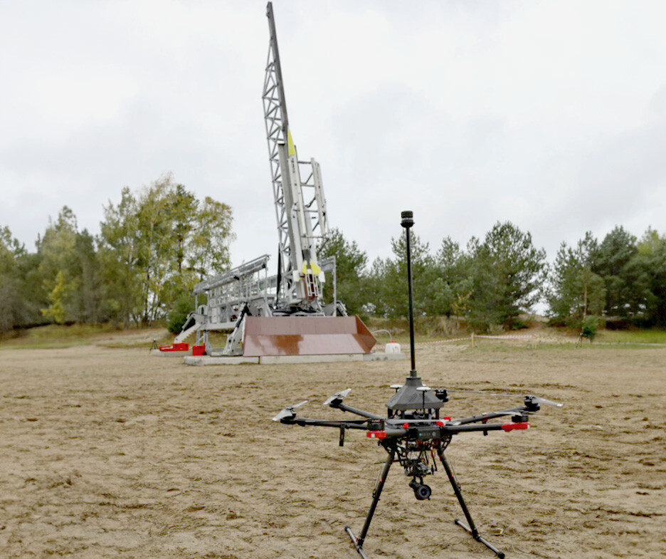
The UAV-based atmospheric sounding system was developed by Łukasiewicz – Institute of Aviation, complementing the atmospheric probing done with meteorological balloons in supporting the launch of ILR-33 AMBER rockets.
Monitoring wind speed and direction is critical during the initial moments of rocket flight when its velocity is comparable to wind speeds. Near-ground atmospheric wind profiles significantly impact rocket trajectories, necessitating accurate and timely data to ensure successful launches.


The challenge
Traditional sources for near-ground wind data, such as wind towers and atmospheric models, present challenges:
Wind towers are costly and unsuitable for many launch sites.
Numerical models lack precision near the launcher due to their large grid sizes (2–10 km).
Meteorological balloons, designed for high-altitude wind profiling, are typically limited to 1–2 launches per flight attempt, leaving gaps in near-ground data.
To ensure safe and accurate rocket launches, there was a pressing need for a cost-effective, high-resolution system capable of frequent and reliable near-ground and at-height wind measurements. A Scout drone provided the required solution.
The solution
This project developed a UAV-based system to address these challenges by providing real-time, on-demand wind profile data near ground level. The system consists of:
- UAV Platform:
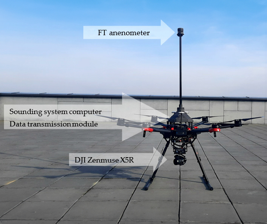
- A DJI Matrice 600 Pro equipped with an FT Technologies Acoustic Resonance ultrasonic anemometer, onboard computer, and data link.
- Custom software for user-defined flight sequences and real-time data visualisation.
- Sensor Integration:
- The Acoustic Resonance ultrasonic anemometer was securely mounted on the UAV to avoid rotor-induced airflow disturbances, using a carbon fiber-reinforced, 3D-printed frame for stability and alignment.
- Operation Process:
- The UAV follows a predefined flight path, collecting atmospheric data up to 500 meters above ground level.
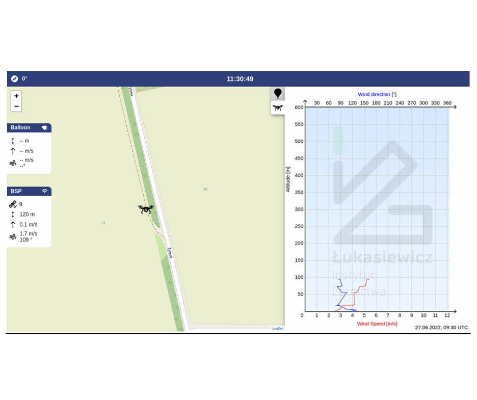
- Data is transmitted to a ground station for visualisation and analysis.
This innovative setup provided a precise and flexible method to gather wind data, aligning with the specific needs of rocket launch operators.

Results
The system was successfully tested in real flight conditions, achieving the following:
- Performance: Automatic flights up to 500 meters above ground level were conducted successfully, demonstrating system reliability and precision.
- Approval: The project received authorization from the Poland Civil Aviation Authority after completing a Specific Operations Risk Assessment (SORA) in collaboration with SORA ASSISTANCE.
- Application: The UAV system was effectively utilized in a suborbital rocket launch campaign, proving its operational feasibility and value.
Conclusion
The integration of UAVs with advanced wind sensors presents a transformative solution for atmospheric monitoring. By providing real-time, accurate near-ground wind data, this system enhances the safety and success of rocket launches while remaining cost-effective and adaptable.
The UAV-based atmospheric sounding system demonstrates the feasibility of using UAVs for automated meteorological measurements, paving the way for broader applications in aerospace and meteorology.
For a more comprehensive understanding, refer to the article “UAV Atmosphere Sounding for Rocket Launch Support” by Bęben K et al., published in Sensors (2023). The article is available at https://doi.org/10.3390/s23249639.
